 vesseltracker.com
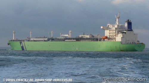
Vessel NY LORD IMO: 9350604, MMSI: 636024958 Lpg Tanker
UTC, 22.83025, 65.53690, course: 14, speed: 1.3
UTC, 22.81844, 65.58387, course: 15, speed: 1.4
2026-03-05 16:28:22 UTC, 22.81844, 65.58387, course: 15, speed: 1.4
Live Vessel NY LORD Analytics (details, animations, etc.)
Live AIS position: UTC. 129 nm SW of Keti Bandar), updated 2026-03-05 16:28:22 UTC.Find the position of the vessel NY LORD on the map. The latter are known coordinates and path.
marine traffic ship tracker show on live map
The current position of vessel NY LORD is 22.81844 lat / 65.58387 lng. Updated: 2026-03-05 16:28:22 UTCCurrently sailing under the flag of Liberia
Details:
Last coordinates of the vessel:
UTC, 22.83025, 65.53690, course: 14, speed: 1.3UTC, 22.83025, 65.53690, course: 14, speed: 1.3
UTC, 22.81844, 65.58387, course: 15, speed: 1.4
2026-03-05 16:28:22 UTC, 22.81844, 65.58387, course: 15, speed: 1.4